Phytogeographic Map
Based on Humboldt’s expeditions
in Colombia and Venezuela
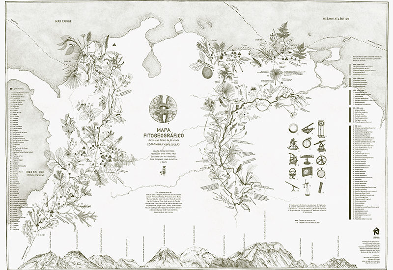
Phytogeographic Map of the New Kingdom of Granada (Colombia and Venezuela) from the routes made between 1799 and 1801 by Alexander von Humboldt, Aimé Bonpland, José de la Cruz and Cachi.
Beyond the anecdotal visual representation of a historical expedition, centered on plants in relation to geography and altitude, we were interested in bringing to the present the particular scientific-poetic look that characterized these trips, in search of understanding the world natural in a more sensitive, deep, delicate and interconnected way. This territory was mainly traveled on foot, a slow pace that allowed to perceive and relate smells and sounds in the landscape, differentiate blues in the sky, forms in vegetation, ambient temperatures, winds and temperaments of animals according to their geographical location to understand how everything in nature is intimately interconnected and the particular conditions of a place mold in a special way to what it keeps alive.
The map includes 70 of the 1707 plants collected and studied during the expedition in the neogranadino territory, the places where they passed, climate and landscape annotations extracted from the travel diaries, volcanoes and mountains mentioned and some of the scientific instruments used .
Illustrations: Juliana Ocampo, Mónica Naranjo and courtesy of the Digital Library of the Botanical Garden of Madrid.
Advice: Alberto Gómez Gutiérrez
Concept, artistic direction and edition: Nómada Ediciones
Special thanks to DAAD Colombia for its support with this project.
70 x 50 cm
2019

